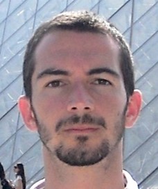
Gregorio Ambrosio Cestero
Contact info
Phone: +34 951929278
E-mail: gambrosio [at] uma.es
Research interests: Computer vision, Data Science, Deep Learning, Machine Learning, Probabilistic Graphical Models.
Data Scientist | B.Sc, M.Sc Computer Science Engineering | MBA Executive | PhD candidate in Mechatronics Engineering
Open Researcher and Contributor ID (ORCID): 0000-0002-1159-0750
Short CV
Gregorio “Goyo” Ambrosio works as Data Scientist at CEMI (Málaga City Computing Center).
Gregorio was born in 1968 and received B.Sc. and M.Sc. degree in Computer Science from the University of Malaga in 1992 and a Master in Business Administration in 2009.
He has over 30 years of professional experience in the ICT field in public administration. He has worked in the field of innovation involved in the most innovative projects of the city of Málaga mainly related to Data Networks and System Development, Smart City, IoT, Data Science and so on.
He is currently a PhD candidate in the MAPIR (MAchine Perception and Intelligent Robotics) research group. He has a solid background in scientific computing and he’s a skilled developer in C++, Matlab and Python. Other programming languages as R and Lisp are part of his skills. He is also an enthusiast of Unix-like systems, Emacs and Literacy Programming.
Gregorio also has experience as an entrepreneur, having led two business projects: one in the field of remote sensing and other in the field of computer forensics.
Currently his areas of interest are computer vision, robotics, and machine learning. Other career areas of interest are data science and computer forensics.


Current project
The Robot@Home2 Dataset or R@H2 for short (paper here) is a collection of raw and processed data from five domestic settings compiled by a mobile robot equipped with 4 RGB-D cameras and a 2D laser scanner. Its main purpose is to serve as a testbed for semantic mapping algorithms through the categorization of objects and/or rooms.
The Dataset in its original version presents a series of challenges for its use. Although the data is in self-descripted files, it is necessary to code ad hoc readers for the extraction and manipulation of this data. On the other hand, the use of intrinsic relationships between the different data entities is left to the implementation of the reading tool.
To improve usability, common data engineering techniques have been applied in this project in an ETL workflow. In the extraction phase, small errors have been cleaned and corrected to later transform the data to a relational model in the next phase, as well as a restructuring of the image and scene files. Finally, the Robot@Home2 Dataset has been converted to a relational database file in SQLite format and a folder structure that contains binary data such as rgbd images and 3D data.
On the other hand, to facilitate the use of the dataset, a toolbox has been developed in order to encapsulate frequent queries as functions and integrate the results with a data analysis library. The toolbox has been coded as a python package that can be easily integrated with other packages, potentially allowing the development of new algorithms without spending a lot of effort on data mining.
Moreover, there is another challenge for people who are not experts in the Python environment. Although the installation of the toolbox is simple, the very nature of the python ecosystem, full of dependencies and complex relationships between the different libraries, sometimes prevents or hinders its use.
Therefore, Robot@Home2 has recently been adapted to the Google environment. The dataset has been shared and is publicly accessible, thus eliminating local download and installation. In addition, a series of notebooks have been published explaining the operation of the toolbox in Google Colab, which provides a development environment that makes the programming experience simple.